
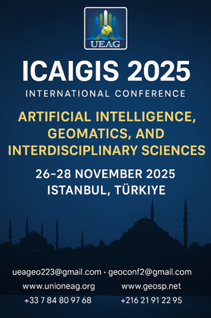
International Conference ICAIGIS 2025
Artificial Intelligence, Geomatics, and Interdisciplinary Sciences
Istanbul, Turkey | November 26–28, 2025
Conference Introduction
In the midst of the rapid transformations shaping our world today, Artificial Intelligence (AI) is no longer merely a technical tool, but a driving force reshaping scientific, economic, and social systems. From this perspective, the International Conference on Artificial Intelligence, Geomatics, and Interdisciplinary Sciences (ICAIGIS 2025) serves as a comprehensive academic platform that bridges deep thought with intelligent application, and scientific vision with technological innovation.
This prestigious international event aims to deepen discussions on the accelerating intersections between AI, geomatics, and applied sciences. Recent advancements in digital analysis and big data have demonstrated that AI is central to addressing complex challenges such as smart city management, climate change monitoring, disease diagnosis, and ecosystem analysis.
Scientific experiences have proven that the integration of AI and geomatics not only enhances the accuracy of modeling and analysis but also opens new horizons for understanding spatial and temporal phenomena from a more holistic perspective. The conference seeks to explore these creative synergies and foster interdisciplinary collaboration across fields such as engineering, medicine, energy, agriculture, environment, and the social sciences and humanities.
ICAIGIS 2025 is not limited to presenting advanced research—it aims to develop a multidimensional intellectual vision, rooted in the convergence of algorithmic analysis, geographic reasoning, and cross-disciplinary scientific thinking, in alignment with the transformations of the digital world and in service of development and innovation goals.
The conference reflects a deep commitment to promoting joint research, encouraging collaborative innovation, and expanding the horizons of knowledge beyond traditional academic boundaries—building intellectual bridges across generations, cultures, and scientific perspectives.
Conference Objectives
- Promote integration between AI, geomatics, and interdisciplinary sciences, including the humanities and social sciences, to build comprehensive insights into complex phenomena in both human and natural environments.
- Explore the practical applications of AI in strategic fields such as health, energy, agriculture, education, the environment, and communities, with a focus on data-driven solutions to real-world challenges.
- Address ethical and legal issues related to AI technologies—such as privacy, transparency, accountability, and algorithmic bias—through diverse philosophical and social approaches.
- Strengthen dialogue between researchers in technical and human sciences to develop AI tools that are more culturally and socially aware and more capable of serving communities fairly and effectively.
- Bridge the gap between academic research and industrial/public policy applications by engaging both public and private sectors, facilitating the transfer of innovation from lab to real life.
- Provide a dynamic academic environment for forming long-term international partnerships, uniting expertise from diverse backgrounds to produce cross-disciplinary, transnational research projects.
- Empower emerging researchers through workshops, training sessions, and student/PhD presentations aimed at enhancing research skills and critical, creative thinking.
Conference Themes
Track 1: Artificial Intelligence and Geomatics
- AI in Remote Sensing
- Smart Geographic Information Systems (GeoAI)
- Intelligent Mapping and Aerial Imaging
- Disaster Management through Spatial Prediction Technologies
- Transportation Networks and Infrastructure Analysis
Track 2: AI in Interdisciplinary Applications
- AI in Healthcare and Medicine
- Smart Learning and Academic Performance Analytics
- AI in Engineering and Manufacturing
- Cybersecurity and Threat Analysis
- AI in Economics and Financial Analytics
- Social and Community Data Analysis
Track 3: Geomatics and Earth Sciences
- AI Applications in Geology and Disaster Monitoring
- Biodiversity and Environmental Monitoring
- Water Resources Management
- Sustainable Urban Planning
Track 4: Ethical, Social, and Legal Aspects
- AI Ethics and Transparency Challenges
- Privacy and Data Protection
- Combating Algorithmic Bias
- International AI Policies and Legislation
Track 5: Emerging Technologies and Innovations
- Explainable Artificial Intelligence (XAI)
- Cloud Computing and Smart Storage Systems
- Virtual and Augmented Reality in Scientific Applications
- Intelligent Robotics
- Big Data Analysis from Multiple Sources
Track 6: AI and Renewable Energy
- Optimizing Solar and Wind Energy Efficiency
- Smart Grids and Predictive Maintenance
- AI in Energy Systems Management
Track 7: Smart Agriculture and Sustainable Food
- Crop Monitoring Using Smart Sensors
- Agricultural Disease Forecasting
- Drone Use in Agriculture
Track 8: Intelligent Transportation and Smart Cities
- AI-Based Transportation Systems
- Smart Cities and the Internet of Things (IoT)
Track 9: Environmental Sciences and Climate Change
- Environmental Pollution Analysis
- Climate Change Adaptation Strategies
- Vegetation Monitoring Using AI
Track 10: AI in Humanities and Social Sciences
- Natural Language Processing (NLP)
- AI in Cultural Heritage Preservation
- Machine Translation and Voice Recognition
Participation & Publication
The ICAIGIS 2025 conference welcomes researchers from all related fields to submit either full research papers or abstracts in English, Arabic, or French, aligned with international academic standards.
- All submissions will undergo double-blind peer review by a specialized scientific committee to ensure quality and originality.
- Individual and joint submissions are accepted, provided they are original and unpublished.
- Accepted papers will be published in:
- The Conference Proceedings Book (with ISBN)
- Or in indexed peer-reviewed partner journals, based on quality and final evaluation.
- All presenters and participants will receive official participation and publication certificates.
Important Dates
| Activity | Date |
| Call for Extended Abstracts Opens | July 20, 2025 |
| Abstract Submission Deadline | October 20, 2025 |
| Final Registration and Confirmation | October 25, 2025 |
| Full Paper Submission Deadline (Optional) | November 26, 2025 |
| Conference Dates | November 26–28, 2025 |
Participation Fees and Benefits
Participation Fees
- Academics & Faculty Members: €350
- Public/Private Institutions & Government/NGO Officials: €450
Participant Benefits
- Lunch and coffee breaks
- Access to conference publications
- Admission to all scientific and training activities
- Official certificates of participation and publication
Honorary Scientific Council
- Prof. Sarkis Fadous – President of the Arab Union of Surveyors; Dean, Faculty of Engineering, Canadian Lebanese University
- Prof. Ronald F. Abler – Former President, International Geographical Union and American Geographical Society
- Prof. Sayed Sayed Al-Husseini – Former President, Egyptian Geographical Society
- Prof. Georg Gartner – Former President, International Cartographic Association
- Prof. Abd Saleh Fayadh – Head, Applied Geology Department, College of Science, University of Anbar, Iraq
Preparatory & Scientific Committees
General Preparatory Committee Chair:
- Dr. Mohamed Ayari – President, Euro-Arab Union of Geomatics
Vice-Chairs:
- Prof. Haidar Hajo Al-Sanousi – Head of Africa & MENA Office, Euro-Arab Union of Geomatics
- Dr. Mounir Arjdal – Head of Turkey Office, Euro-Arab Union of Geomatics
- Dr. Mahmoud Al-Mahmoud – Consultant, Euro-Arab Union of Geomatics – Qatar
Scientific Council Chairs:
- Prof. Salwa Saidi – Geomatics Coordinator, Faculty of Science, Tunis El Manar University
- Prof. Jean Doumet – Chair, Department of Geography, Lebanese University
High Scientific Committee of the Conference
- Professor Mohamed Sirto – Kingdom of Morocco
- Dr. Nejib Belhabib – President of the Higher School of Technology and Business Administration, Tunisia
- Professor Alain Ethmane – France
- Professor Mohamed Al-Muqri – Kingdom of Saudi Arabia
- Professor Hussein Nechniche –Algeria
- Dr. Osama Kashada – Scientific Research Forum for Sustainable Development,Libya
- Professor Philippe Di Bois – Euro-Mediterranean Union for Scientific Research and Technological Innovation
- Dr. Habibi Yahyaoui – Director of Institute of Earth Sciences and Universe – Batna 2 University–Algeria
- Professor Abd-Saleh Fayadh – Head of the Department of Applied Geology, College of Science, University of Anbar, Republic of Iraq
- Professor Naima El Aissaoui – Kingdom of Morocco
- Professor Ruqayya Amin Al-Ani – Iraqi University, Republic of Iraq
- Dr. Mounir Arjdal – Kingdom of Morocco
- Professor Omar Chermiti – Republic of Tunisia
- Professor Othman Sharkas – State of Palestine
Members of the High Scientific Committee
- Dr. Mohamed Idriz – University of Tripoli, State of Libya
- Dr. Nouman Bakkari – Faculty of Sciences, University of Tunis El Manar, Republic of Tunisia
- Dr. Mohamed Hamdi – Canada
- Dr. Saadia Al-Harti – Professor of Higher Education – Department of Earth Sciences – Faculty of Science – Mohammed V University – Rabat – Morocco
- Dr. Samar Saqr – Lebanese University, Republic of Lebanon
- Dr. Miftah Al-Fetni – Al Asmarya University, Libya
- Dr. Said Sofiane – Algerian Geographical Society, Algeria
- Dr. Saleh Zraib – University of Batna, Algeria
- Dr. Louiza Amrouche – Algeria
- Professor Beya Tayachi – University of Tunis El Manar, Tunisia
- Professor Ali Abu Azzoum – Director of the Arab Center for Desertification Studies, Libya
- Professor Tarek Al-Rashed – United States of America
- Dr. George Abi Diwan – Lebanese University, Lebanon
- Professor Brice Anselme – France
- Dr. Othman Al-Mahdi Mikael – Associate Professor – University of Tobruk – Libya
- Dr. Evgeny Kiselev – Russian Federation
- Dr. Amin Baraka – King Faisal University, Republic of Chad
- Eng. Mohamed Al-Barqawi – ACSAD (Arab Center for the Studies of Arid Zones and Dry Lands)
- Dr. Siddiq Noreen – Kingdom of Saudi Arabia
- Dr. Fatma Taqtaq – Tunisia
- Dr. Asmaa Al-Ketbi – President of the Emirates Geographical Society, United Arab Emirates
- Dr. Rudwan Hussein – Dean of the Faculty of Information Technology, University of Tripoli, Libya
Preparatory Committee Members
- Eng. Helmi Lamouchi – Tunisia
- Mr Amin Salih – Libya
- Eng. Imad Belhechmi – Tunisia
- Mr. Mohamed Idriz – Libya
- Dr. Mounir Arjdal – Morocco
- Mr. Abdelbaset Khadhrawi – Tunisia
- Mr. Emin Ben Othman – Tunisia
- Mr. Ali Naji – Tunisia
- Mr Mohammed Bawendi – Libya
- Ms. Dalila Aouani – Tunisia
- Ms. Chaima Dridi – Tunisia
- Ms. Hala Al-Saeedi – Tunisia
- Mr. Mohsen Belarbi – Tunisia
- Ms. Hanan Bou Allague – Tunisia
Our Partners
- SUPTECH – Private University of Technology and Business Administration
- DACFS – Arab-Danish Center for Future Studies, Copenhagen, Denmark
- Arab Union of Surveyors
- Emirates Geographical Society
- International Geographical Union (IGU)
- International Cartographic Association (ICA)
- Sudanese National Geographic Society
- Euro-Mediterranean Federation for Scientific Research and Technological Innovation
- Maghreb Organization for Geographic Information Systems and Remote Sensing
- Geographical Sciences Publications (MAG)
- French Organization for Scientific and Cultural Exchange with the Maghreb and the Middle East
- Association Africa 50 – France
- Association of Friends of Francophone Africa
- Order of Licensed Surveyors in Lebanon (OGTL)
- Al-Zaeem Al-Azhari University – Sudan
- Geomatics Club, Faculty of Sciences, Tunis
Call for Papers & Posters
The ICAIGIS 2025 Preparatory Committee invites researchers and academics to submit their research papers or scientific posters by October 20, 2025.
1. Research Paper Submission Guidelines:
- Accepted Languages: Arabic, French, or English
- Abstract must include:
- Paper title
- Author(s) name(s)
- Affiliation
- Abstract text (max 300 words)
- Keywords
- General Conditions:
- Original work not presented/published previously
- CV and personal photo (for journal publication in Geographical Sciences Publications)
- Submission Email: geoconf2@gmail.com
2. Poster Presentation Guidelines:
- Accepted Languages: Arabic, French, or English
- Poster Abstract Must Include:
- Title
- Author(s) name(s)
- Affiliation
- Abstract (max 300 words)
- Keywords
- Confirmation of originality
- Technical Requirements:
- Poster size A0 (or researcher’s choice)
- Must align with conference themes and standards
- Subject to peer review
Poster Submission Deadline: October 26, 2025
Important Notes for All Participants
- Participants will receive official certificates of attendance and presentation.
- Accepted papers and posters will be published as part of the official conference outputs.
- Outstanding abstracts may be recommended for extended review and publication in partner journals.
Contact Information
Euro-Arab Union for Geomatics
- Address (France): 125 bis, Rue Pierre Valdo, 69005 Lyon 5 – France
- Address (Tunisia): 112 Rue Radhia Haddad, 1001 Tunis – Republic of Tunisia
- WhatsApp (France): +33 7 84 80 97 68
- WhatsApp (Tunisia): +216 21 91 22 95
- Email: ueageo223@gmail.com
- Email: geoconf2@gmail.com
2. Geomatics and Sustainable Development Investment Salon
Location: France
Date: 2026
Description:
A specialized investment salon aiming to connect entrepreneurs and investors with innovative projects in geomatics and sustainable development. The event features project exhibitions, business matchmaking sessions, and high-level dialogues on investment opportunities and partnerships.
3. Geographic Information Systems (GIS) Training Course
Location: Tunis, Tunisia
Date: December 2025
Description:
An intensive, hands-on training program designed for engineers, researchers, and postgraduate students. Delivered by international specialists, the course covers both theoretical foundations and practical applications in GIS, with an accredited certificate awarded upon completion.
4. Euro-Arab Union of Geomatics Consultative Forum
Location: Saudi Arabia
Date: July 2025
Description:
A consultative gathering of Union members, experts, and institutional partners, aimed at reviewing progress, discussing strategic priorities, and enhancing coordination for upcoming joint initiatives. The forum serves as a platform for collaborative planning and internal policy development.
5. Creative Excellence Award
Location: France
Date: April 2026
Description:
An international award recognizing individuals and institutions for exceptional achievements in geomatics, scientific innovation, and environmentally driven entrepreneurship. Winners are selected through a transparent evaluation process and honored at a formal ceremony.
6. Arab Geographical Medal of Honor
Date: 2026
Description:
A prestigious honorary award granted to distinguished Arab figures who have made significant contributions to the advancement of geography and geospatial sciences in the Arab region. It symbolizes appreciation for academic and professional excellence in the field.
7. General Conference of the Euro-Arab Union of Geomatics
Date: March 2027
Description:
The Union’s most significant official assembly, bringing together members of the General Assembly, scientific and economic partners, and international observers. The conference includes leadership elections, strategic reviews, and the launch of future cross-regional programs.